
De Bry Rare Books
1774 Captain James Cook - Antique Map - 1st Printed Chart of New Zealand -French
1774 Captain James Cook - Antique Map - 1st Printed Chart of New Zealand -French
Regular price
£0.00 GBP
Regular price
Sale price
£0.00 GBP
Unit price
per
Tax included.
Shipping calculated at checkout.
Couldn't load pickup availability
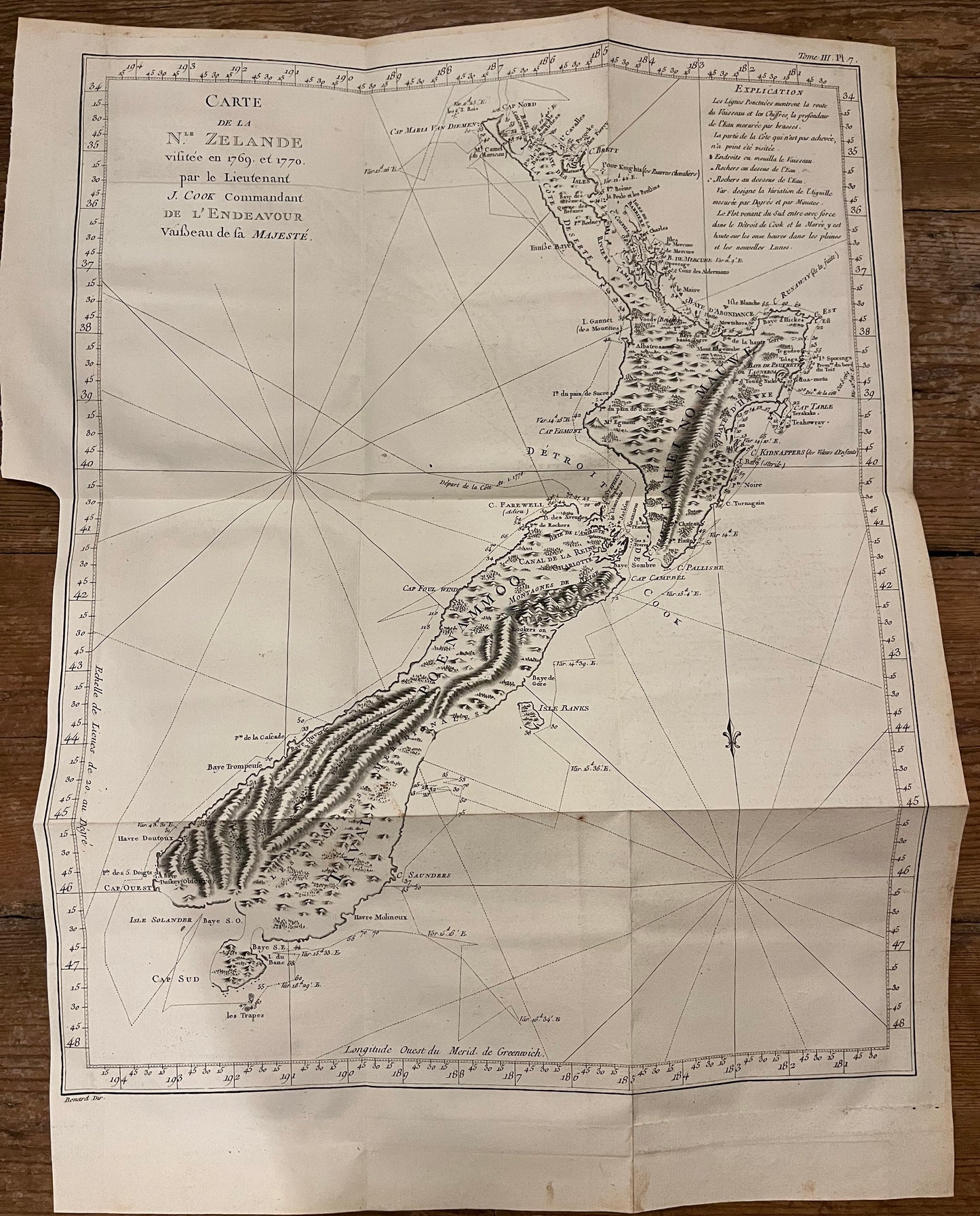
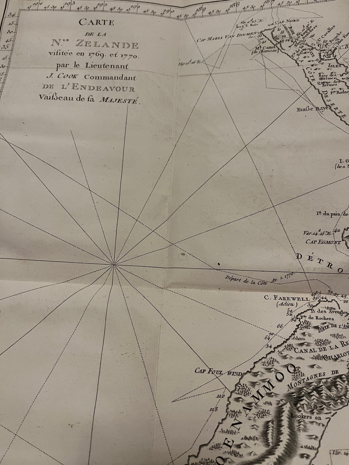
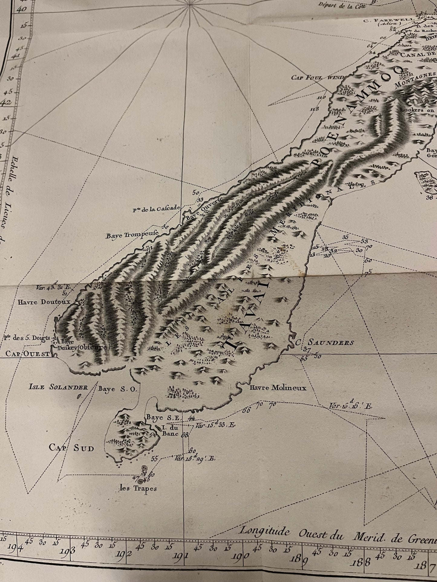
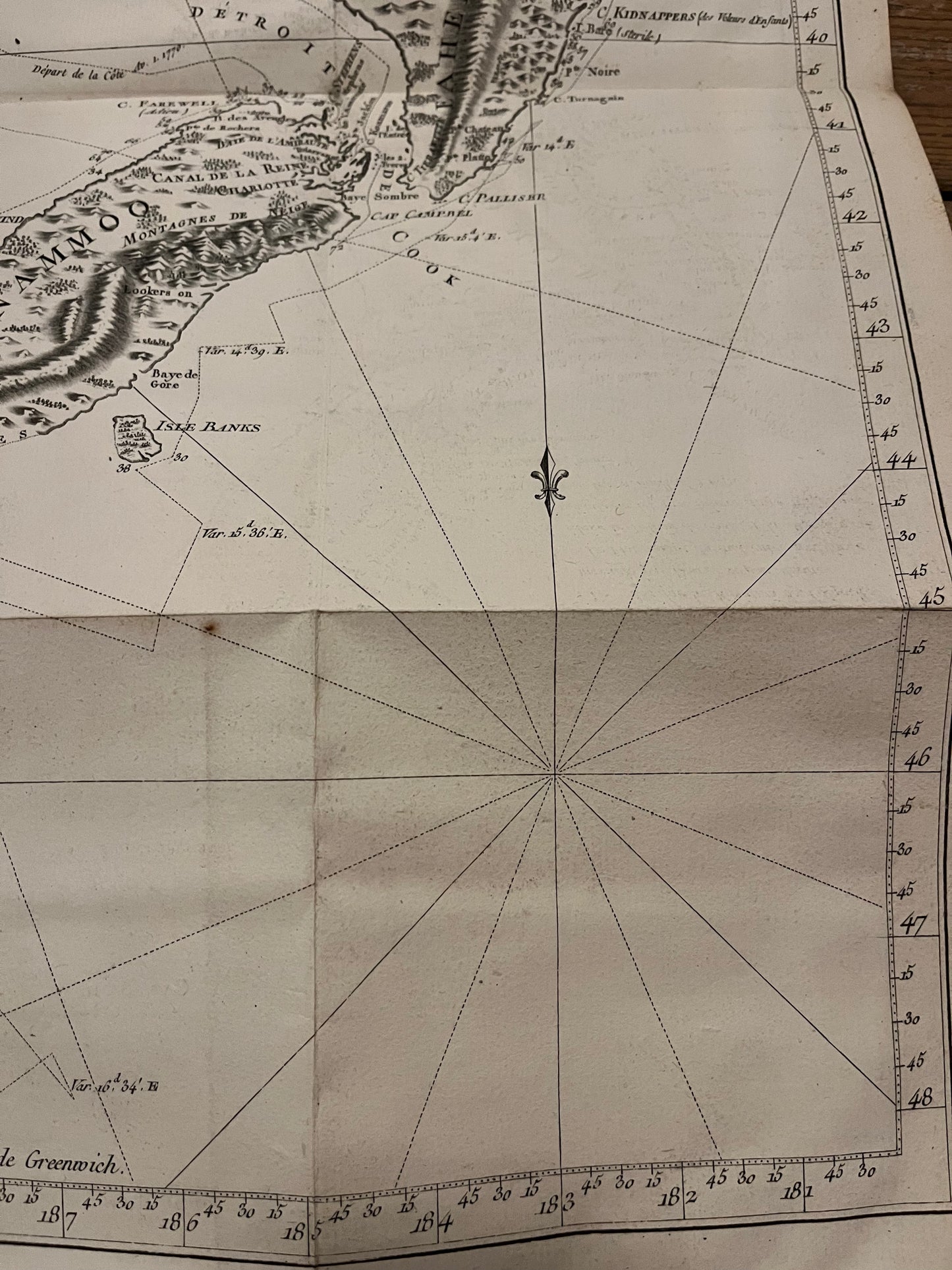
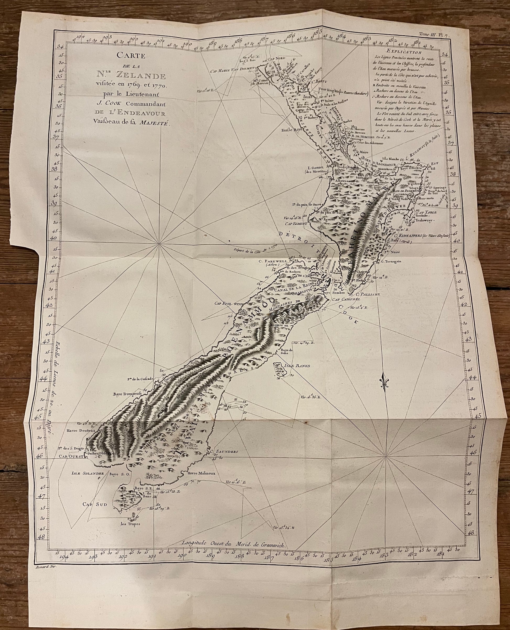
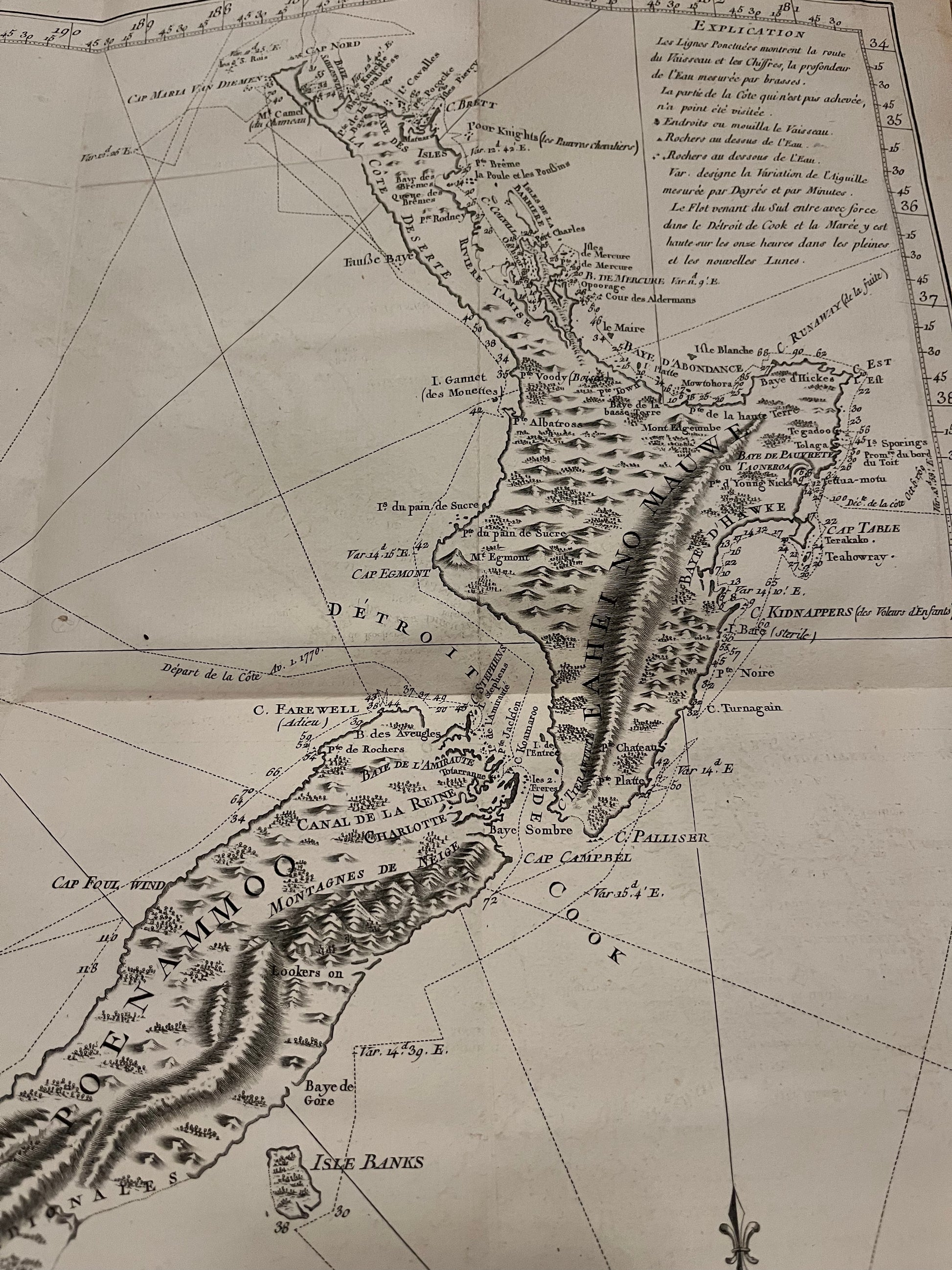
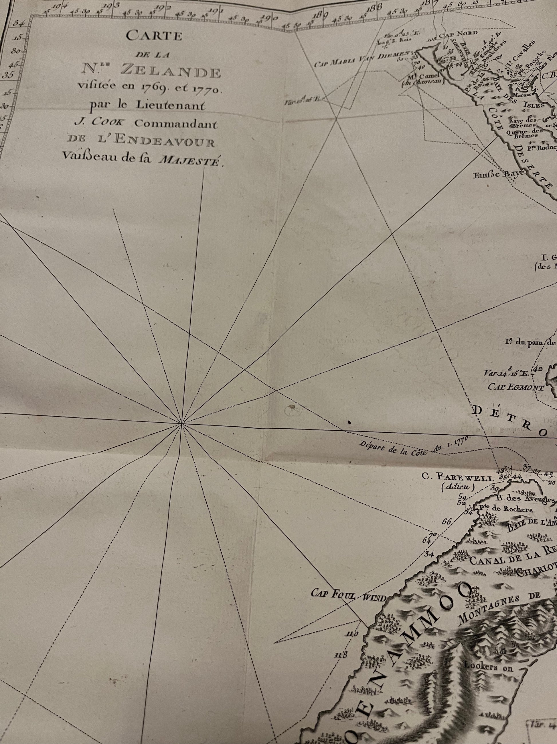
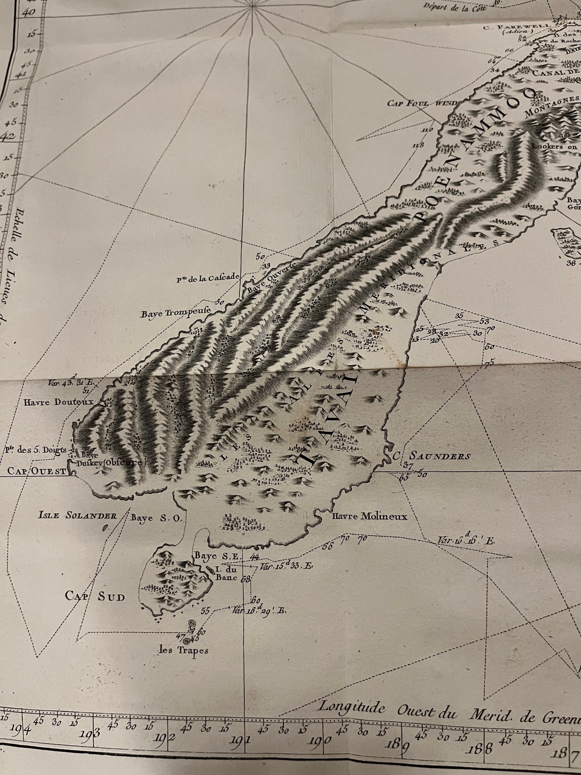
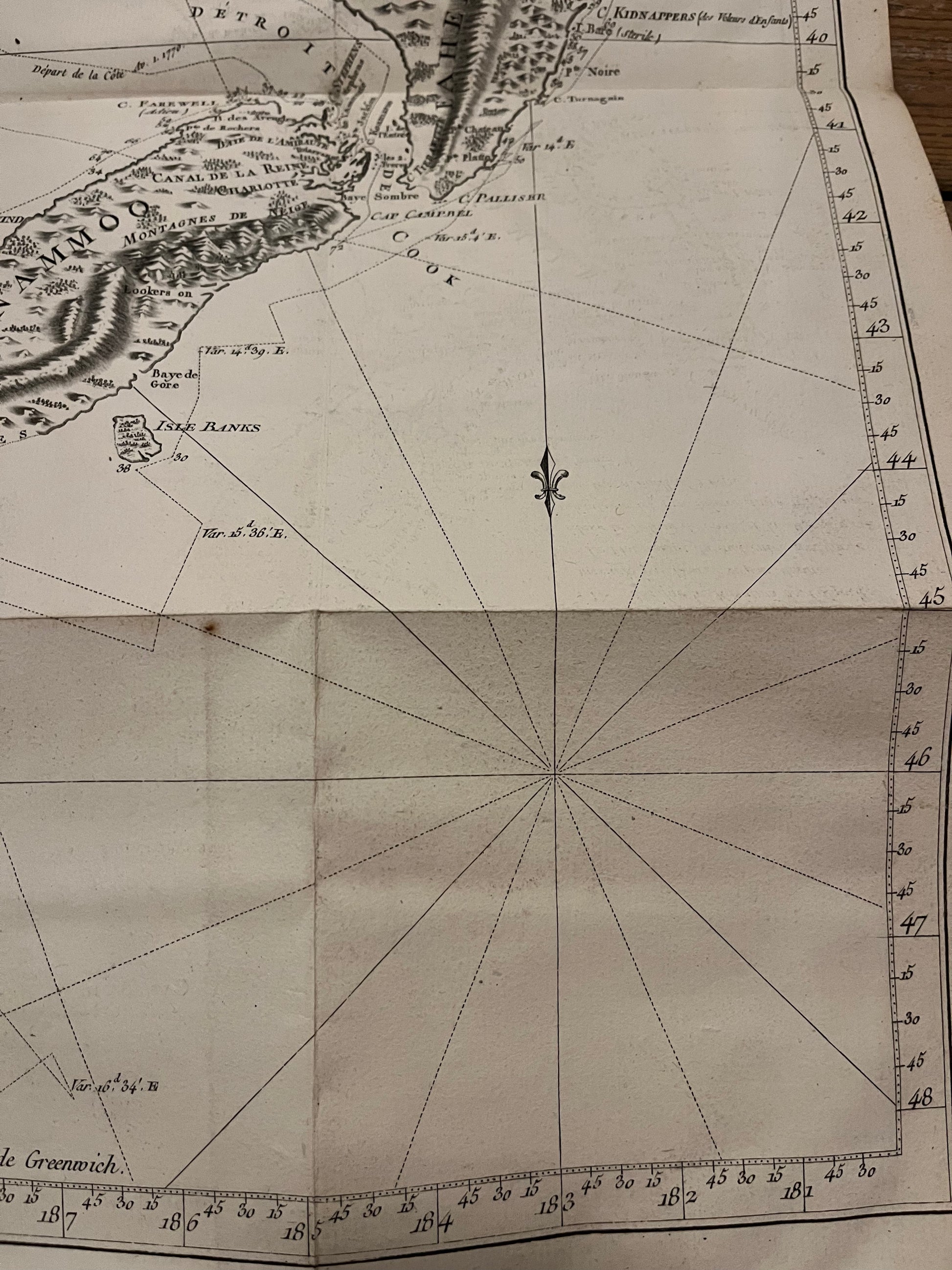
"Carte De La Nle.Zelande visitee en 1769 et 1770 par le Lieutenant J. Cook Commandant De L'Endeavor Vaisseau de la Majeste"
Chart of New Zealand visited in 1769 and 1770 by Lieutenant James Cook, commander of the ship the Endeavour for his Majesty"
Engraved by Benard (after Bayly)
This is the first French edition of this landmark map of New Zealand
42 x 52cm
A clean copy of this important map with wide margins. Folded as issued.
James Cook Circumnavigated New Zealand over 6 months between 1769-1770 in the ship the Endeavour. The chart shows remarkable accuracy given the technology of the time (no accurate sea clocks for Longitude).
An early, beautiful and uncommon map of New Zealand.