
De Bry Rare Books
Complete Second Edition of Ogilby's Britannia with 100 plates - "Britannia: or the Kingdom of England and Dominion of Wales Actually Survey'd"
Complete Second Edition of Ogilby's Britannia with 100 plates - "Britannia: or the Kingdom of England and Dominion of Wales Actually Survey'd"
Couldn't load pickup availability
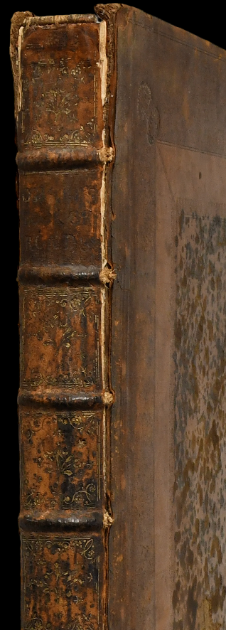
"Britannia: or the Kingdom of England and Dominion of Wales Actually Survey’d: with a Geographical and Historical Description of the Principal Roads; Explain’d by One Hundred Maps on Copper-Plates”
– John Ogilby
– Published in London by Abel Swall and Robert Morden in 1698
– Folio. Engraved title, 100 double-page strip road maps (complete). Title-page with two small repairs; preliminary text browned; maps with variable age-toning and browning, a few with marginal tears and repairs, occasional vertical creasing. Leaves re-guarded.
– Contemporary panelled calf (rubbed, joints cracked, later endpapers).
An uncommon complete copy of the second edition of Ogilby’s landmark road atlas. First published in 1675, Britannia was the first national road atlas of England and Wales, featuring highly detailed strip maps based on actual survey. The 1698 edition preserves Ogilby’s innovative cartographic method, which became foundational for the mapping of Britain’s transport network.
Provenance: Sir Brooke Boothby; ex Fonmon Castle.