DeBryRareBooks
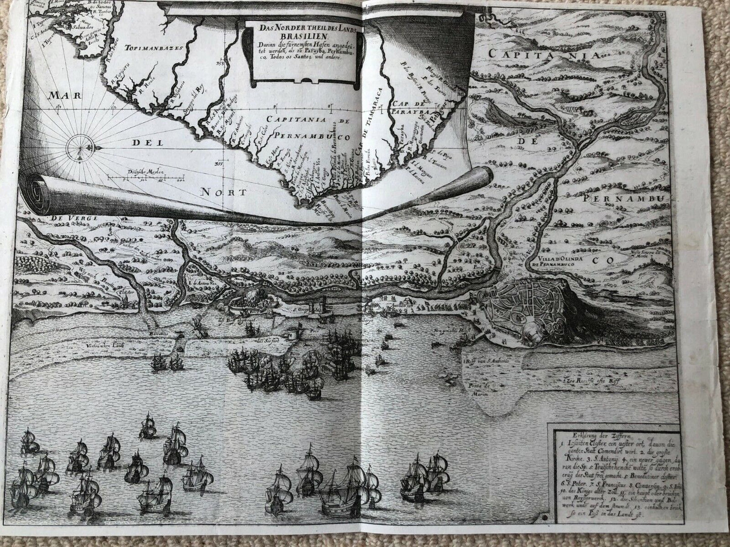
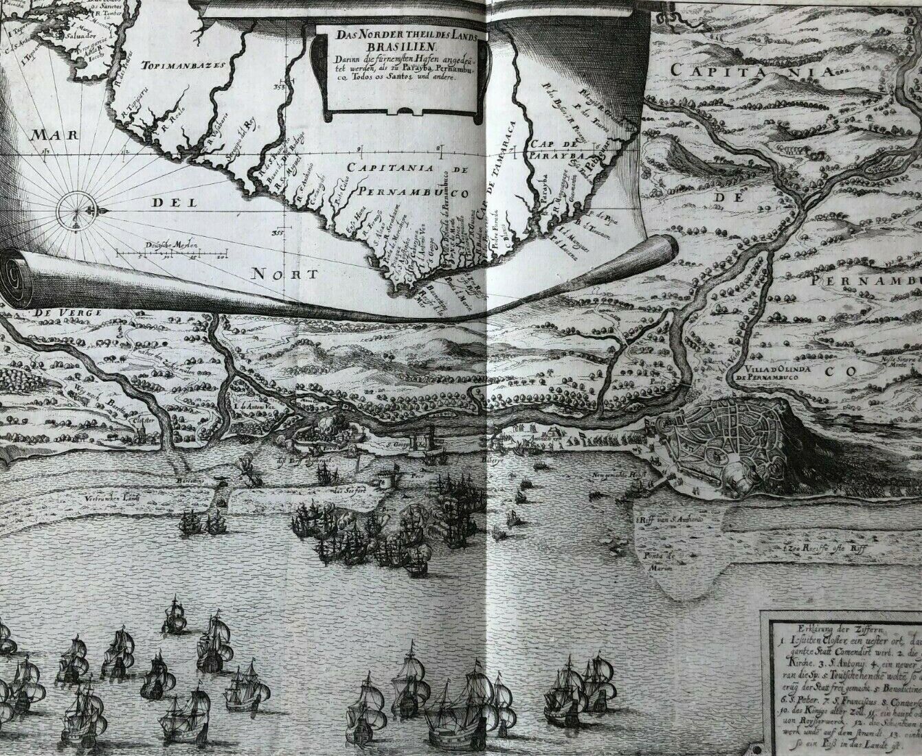
De Bry “Norder Theil des lands Brasilien" - c1630 - Brazil - Olinda - Pernambuco
De Bry “Norder Theil des lands Brasilien" - c1630 - Brazil - Olinda - Pernambuco
Couldn't load pickup availability
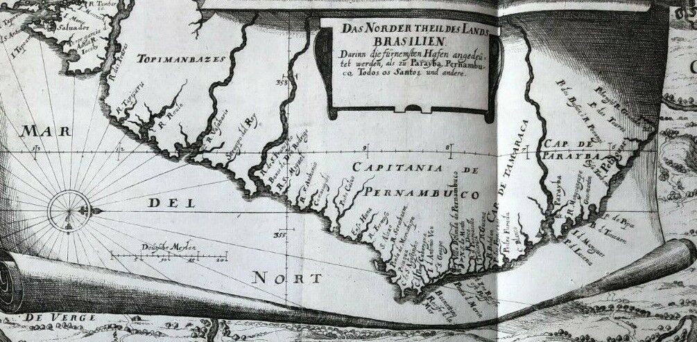
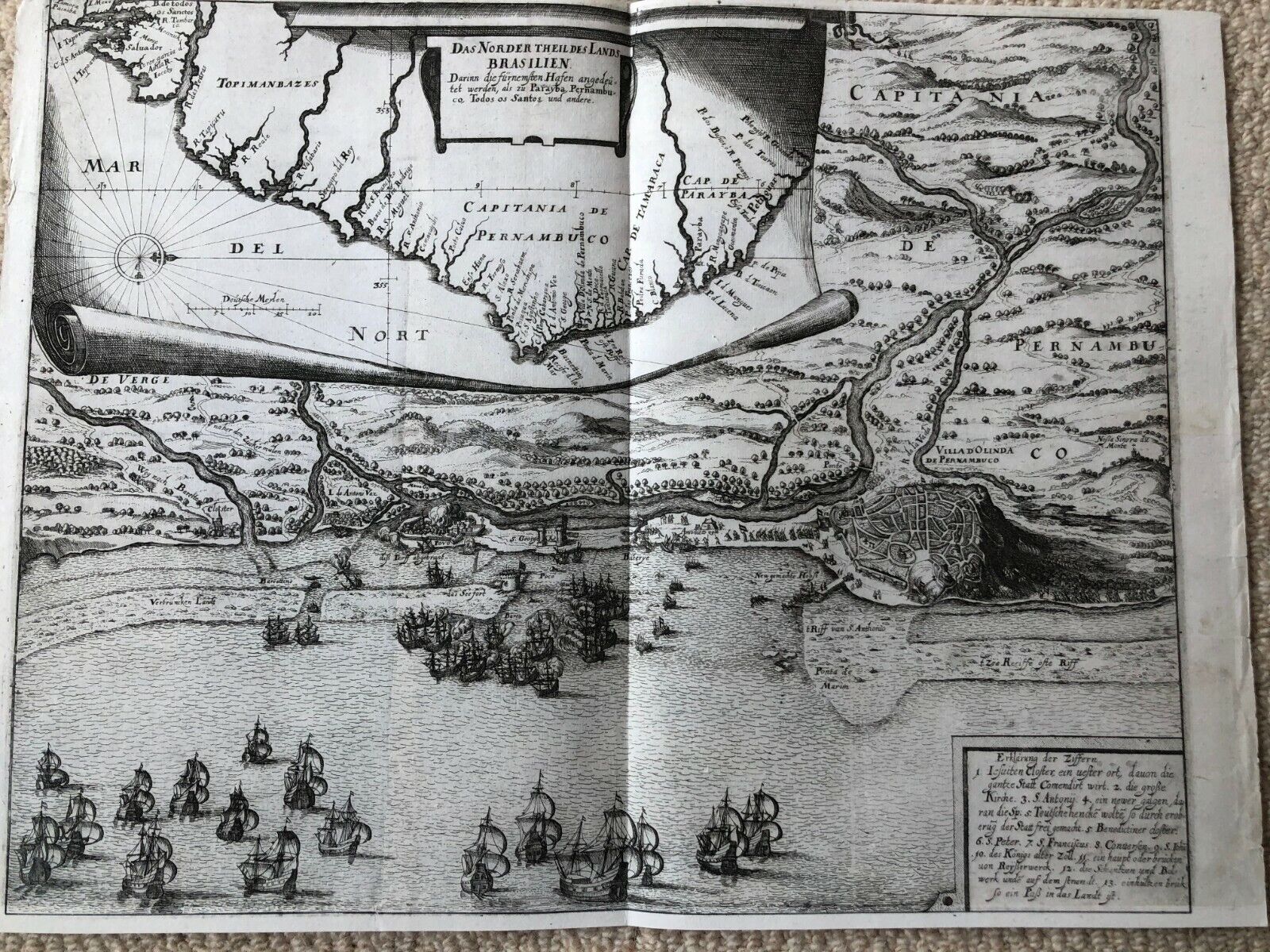
"Das Norder Theil des Lands Brasilien"
-Original Copperplate Engraving
-Theodore De Bry (1528-1598)
-Large size - 17.5 x 14 inches
-Circa1630
-Very Good condition - Professionally restored and remargined
-Verso blank
This map is from part 13 of De Bry's Grand Voyages.
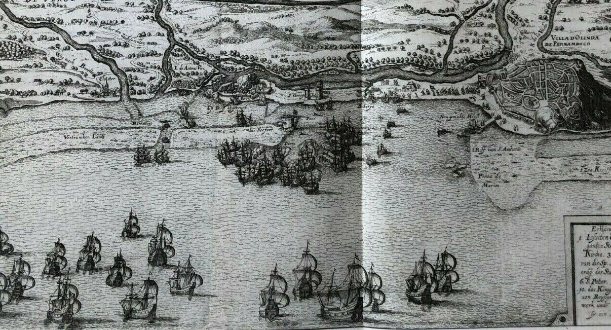
The engraving shows the Dutch invasion of Olinda, in Pernambuco, which took place in 1630. The Dutch were fighting to gain control of the port which was the gateway to the largest sugar producing region in the world. 65 ships, under the command of Hendrick Corneliszoon Loncq succeeded in capturing the port from the Portuguese. In the short term, the Dutch were successful in controlling trade in Brazil. But after a significant loss in 1649, the Dutch gradually gave back control to the Portuguese, eventually formally withdrawing in 1661.
In the upper area of the map the Brazilian coast is shown with the the state of Pernambuco. The map is beautifully designed and rich in detail.