De Bry Rare Books
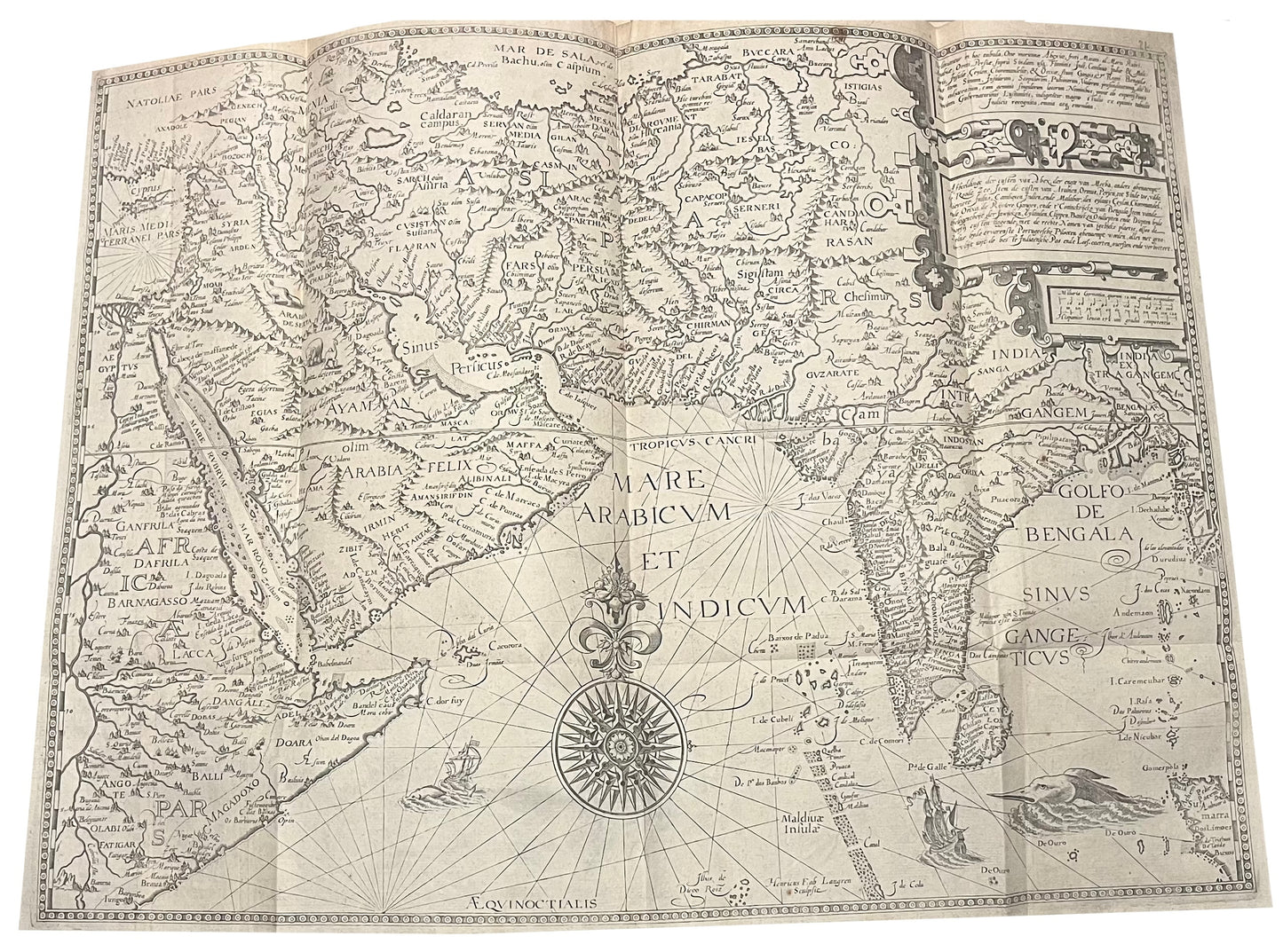
Linschoten - 1596 - Middle East and India - Deliniantur in hac tabula, Orae maritimae Abexiae, freti Mecani: al. Maris Rubri: Arabiae, Ormi, Persiae, Supra Sindam usque
Linschoten - 1596 - Middle East and India - Deliniantur in hac tabula, Orae maritimae Abexiae, freti Mecani: al. Maris Rubri: Arabiae, Ormi, Persiae, Supra Sindam usque
Regular price
£0.00 GBP
Regular price
Sale price
£0.00 GBP
Unit price
per
Tax included.
Shipping calculated at checkout.
Couldn't load pickup availability
"Deliniantur in hac tabula, Orae maritimae Abexiae, freti Mecani: al. Maris Rubri: Arabiae, Ormi, Persiae, Supra Sindam usque"
-Jan Huygen van Linschoten
-1596.
-The map depicts
-Beautiful 16th Century Engraved Map of West and South Africa by Linschoten.
-Very good condition - minor repair at centrefold without loss
-Folds (as issued)
The chart was drawn from Secret Portuguese charts, which were obtained by the Dutch. The chart is beautifully engraved with a magnificent compass rose, ships in the sea, and sea monsters. Inland a Lion, elephant and giraffe are found on the Arabian peninsular while a pair of unicorns are seen in India. The map shows the Middle East and India, from Cyprus and the Eastern Mediterraniean and Africa, Arabia, India and Pakistan, across to the tip of Sumatra. The coastal regions and densely annotated with the names of the cities and towns, while inland is often more fanciful and less accurate.
Linschoten (1563-1611), a young Dutch man, sailed to Goa in 1583 as the Secretary to the Archibishop of Portuguese Goa. Having grown up in Enkhuizen in Holland, he moved to Seville and then Lisbon as a teenager to be with his elder bothers. He learnt the languages, and the ways of a merchant before taking the opportunity to sail to Goa. Once in there, he wrote a journal of his experiences which vividly described life in India. He not only described day to day life of the Portuguese living there, but also described the peoples, the flora and fauna and the surrounding region. On his return he was encouraged to publish his account, which was embellished with entries from a knowledgable local doctor, Paludanus, and 6 beautiful maps. Linschoten would later sail to the Arctic with Barentz, famously overwintering there with his crewmates when the ship became trapped in the ice. In his later years he became town treasurer to Enkhuizen, where he died in 1611.


