De Bry Rare Books
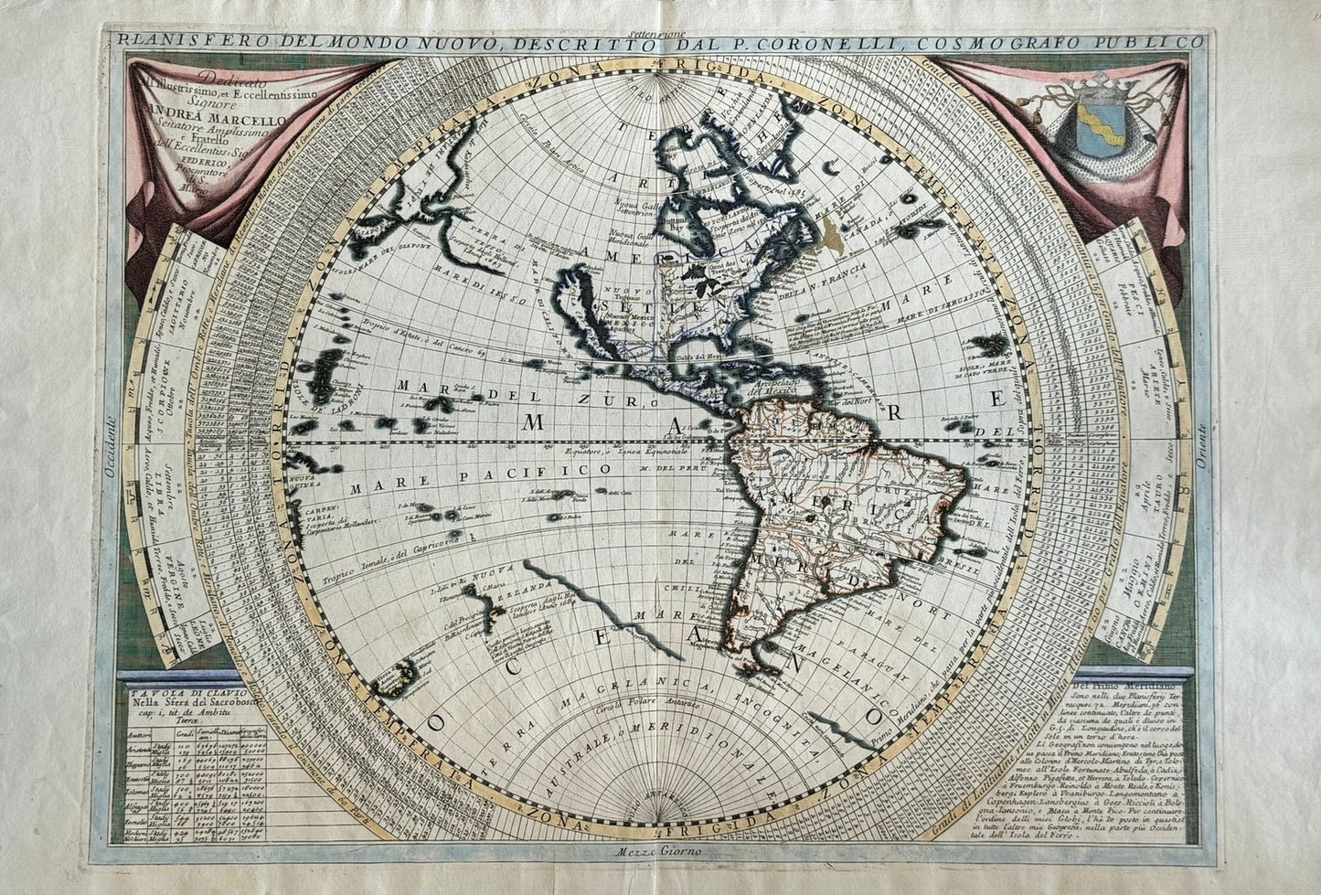
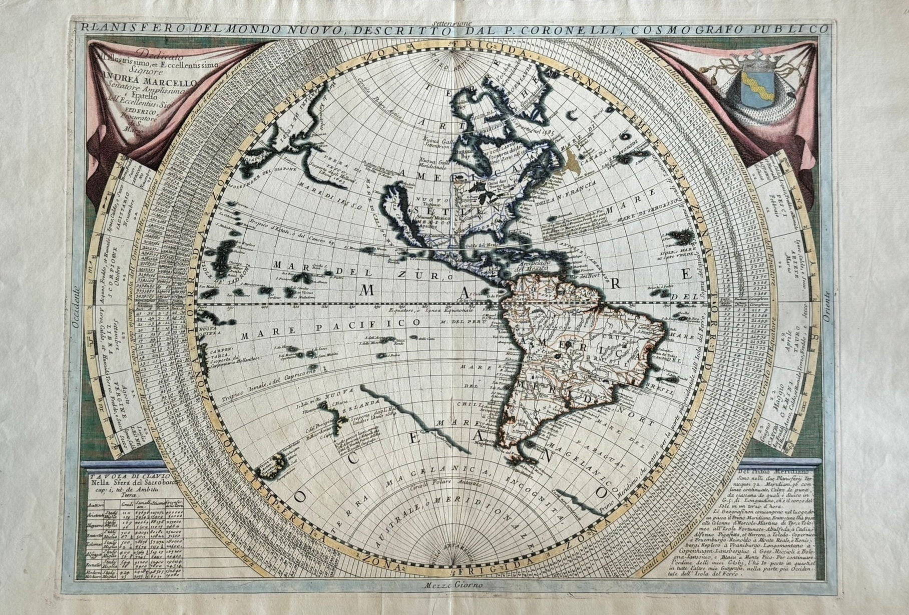
“Planisfero Del Mondo Nuovo, Descritto Dal Coronelli” Vincenzo Coronelli (1650 – 1718) Atlante Veneto published in Venice c1690
“Planisfero Del Mondo Nuovo, Descritto Dal Coronelli” Vincenzo Coronelli (1650 – 1718) Atlante Veneto published in Venice c1690
Couldn't load pickup availability
"Planisfero Del Mondo Nuovo, Descritto Dal V. Coronelli"
Vincenzo Coronelli (1650 – 1718)
Atlante Veneto published in Venice c1690
430 x 590mm
Lovely map of the Western Hemisphere with decorative cartouches surrounded by interesting tables of latitudes and other numeric information. Modern colour in very good condition with old fold.
Vincenzo Coronelli was a Franciscan Priest in Venice, and one of the most celebrated cartographers of the 17th Century. He is best known for designing and producing large globes for King Louis XVI
The map has an up to date depiction of the Eastern Coast the Americas. The West coast of North America, however, is less accurate and California is displayed as an Island. The Pacific is largely unknown at this time, with the imaginary Lesso landbridge between Russia and Alsaka tentatively displayed. The outlines of Northern New Zealand and Tasmania (Van Diemens Land) are here shown using the information from Tasman’s famous voyage in the 1640s. The Islands Li Monaci, La Disgraciata and La Vezina are likely the Hawaiian Islands which although are at the correct latitude on this map, were not placed at the correct longitude. These islands may have first been identified by the Spanish over 200 years before James Cook would accurately chart them in the 1770s.
£1850


