
DeBryRareBooks
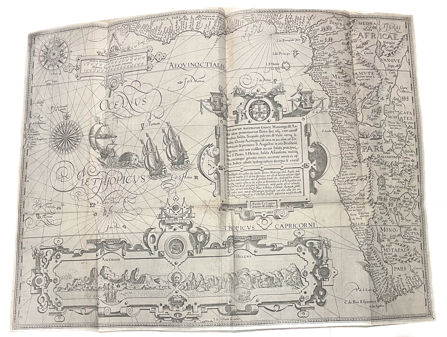
Typus Orarum Maritimarum Guineae, Manicongo & Angolae - Jan Huygen van Linschoten
Typus Orarum Maritimarum Guineae, Manicongo & Angolae - Jan Huygen van Linschoten
Couldn't load pickup availability
"Typus Orarum Maritimarum Guineae, Manicongo & Angolae."
-Jan Huygen van Linschoten
-1596.
-The map depicts the West coast of Africa, from modern day Guinea and Nigeria, to South Africa.
-Beautiful 16th Century Engraved Map of West and South Africa by Linschoten.
-Very good condition - minor repair at centrefold without loss
-Folds (as issued)
The chart was drawn from Secret Portuguese charts, which were obtained by the Dutch. The chart is beautifully engraved, and contains depictions of Lions, Elephants, Rhinos and snakes, alongside Mermaids in lake Zaire. Three ships in full sail surround a sea monster in the Atlantic and two windroses are finely engraved. Delicately engraved cartouches show the coastlines of Ascension Island and St Helena - two important stop overs for sailors on the long voyage to the East.
Linschoten (1563-1611), a young Dutch man, sailed to Goa in 1583 as the Secretary to the Archibishop of Portuguese Goa. Having grown up in Enkhuizen in Holland, he moved to Seville and then Lisbon as a teenager to be with his elder bothers. He learnt the languages, and the ways of a merchant before taking the opportunity to sail to Goa. Once in there, he wrote a journal of his experiences which vividly described life in India. He not only described day to day life of the Portuguese living there, but also described the peoples, the flora and fauna and the surrounding region. On his return he was encouraged to publish his account, which was embellished with entries from a knowledgable local doctor, Paludanus, and 6 beautiful maps. Linschoten would later sail to the Arctic with Barentz, famously overwintering there with his crewmates when the ship became trapped in the ice. In his later years he became town treasurer to Enkhuizen, where he died in 1611.